
Tamga Guide
Red sand, petroglyphs and gorge hikes on Issyk-Kul's south shore
1 selected
Tamga is a village in the Issyk-Kul region of Kyrgyzstan, on the middle stretch of the lake's south shore. The beach with red sand lies about 1 km from the village. Above the whole southern shore rises the Teskey Ala-Too Range of the Tian Shan.
Lake Issyk-Kul measures 182 km in length and up to 60 km across, and it plunges to 668 m. That makes it the eighth-deepest lake on earth. Its name means Hot Lake, and hot springs help feed it. Around 118 rivers and streams run into the water as well. Near Tamga the lake rarely freezes, even though the winters are cold, thanks to the salt it carries.
Behind the village, on dry hills, you will find a cemetery with both Christian and Muslim graves. Fairy Tale Canyon, also called Skazka Valley, lies 4 km from Tosor, a village that belongs to Tamga. Its sandy red and yellow rock formations look like snakes, dragons, sleeping giants and castles. The walk there is easy, and from the canyon you get a panorama of Lake Issyk-Kul and snow-capped mountains.
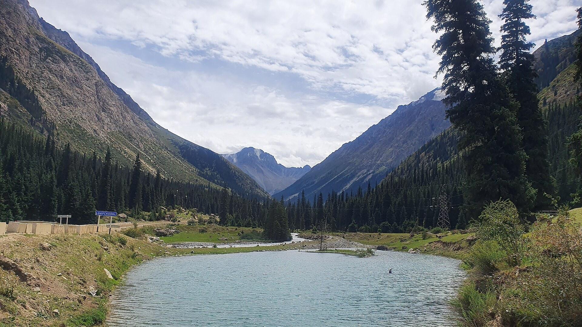
Barskoon gorge and its waterfalls sit 20 km south of Tamga along route A364. A hike through the gorge takes 2-4 h return and climbs from 2,350 m to 3,300 m. Spring suits it best, when the meltwater is strongest. Kara Kul, a salt lake near Tamga, is less salty than the lakes in Tong district.
Tamaras Guesthouse B&B, next to the bazaar in Tamga, can arrange horse tours with a guide. Old horses are available for inexperienced riders.
Tamga is the seat of one of the 13 rural communities of Jeti-Ögüz District. The district counts 47 villages and takes its name from the Jeti-Ögüz rock formation, which means Seven Bulls. It covers much of the eastern end of the Terskey Ala-Too Range, including the Barskoon and Jeti-Ögüz rivers.
Karakol, the capital of Issyk Kul Oblast, sits at the far end of the lake. From there, Karakol Ski Base lies about 30 min away at 3,040 m and is the highest ski resort in Central Asia, with T-bars and rope lifts but no chair lifts. The Altyn Arashan hot springs, with hostels, yurts and food, are within hiking distance of Karakol.
Gagarin, a mystery inscription and old stones around Tamga
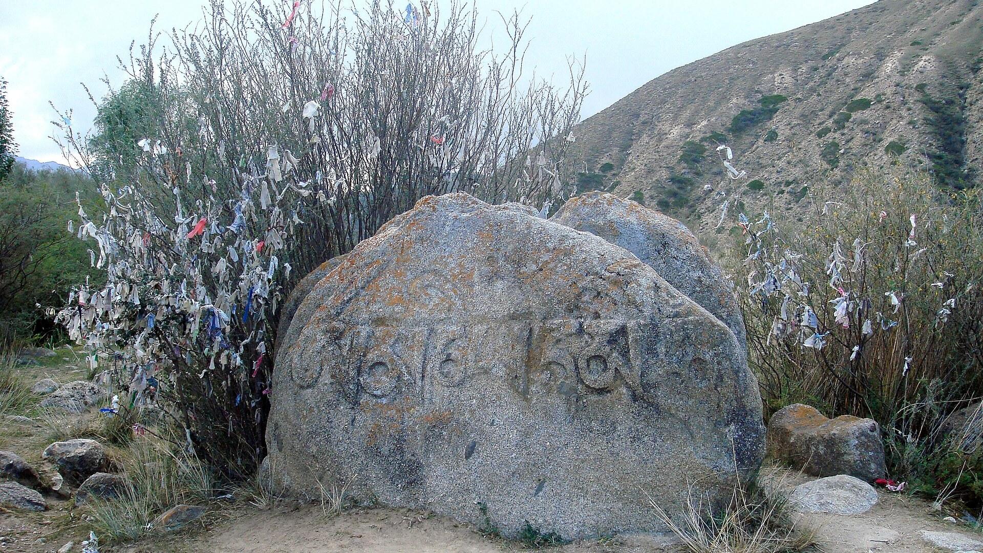
The village of Tamga got its name from an old petroglyph text, and the name can be read as the word letter, though nobody has translated the inscription so far. The text is of unknown age. Some people speculate that it is written in an old Tibetan language. The petroglyphs are hard to find on your own, so ask for a guide; they lie around 20 min by horse from the centre of Tamga. South of the village stands Tamga Tash, a rock carved with the Buddhist inscription Om Mani Padme Hum. It dates from the 3rd to 8th centuries, and locals read it as Tamga. The sanatorium at Tamga is where Yuri Gagarin prepared for the very first flight into space. Two busts of Gagarin stand at the foot of the Barskoon gorge near Tamga. Another monument near Tamga honours Sayakbol Karalaev, the famous teller of the Manas epic, who lived from 1894 to 1971. Lake Issyk-Kul was a stopover on the Silk Road, and the Chinese monk Xuanzang noted it in the 7th century. Karakol was called Przhevalsk in Tsarist and Soviet times and holds the resting place of the Russian explorer Nikolai Przewalski. The Przevalski Museum and Memorial near Karakol keeps documents and photos of him. He died in 1888, and his tomb lies nearby. The Dungan Mosque in Karakol was built between 1904 and 1907 by an architect from Beijing, without any metal reinforcement, and it holds 42 pillars. Karakol's Holy Trinity Church was consecrated in 1895. The first church there went up in July 1869, and an earthquake destroyed it in 1889. The Karakol Regional Museum shows Scythian artifacts, petroglyphs, Kyrgyz leatherwork, felt wall hangings and national costumes.
Lagman, manty and kymys in and around Tamga
Food in Tamga is plain Kyrgyz cooking: behind the main sanatorium entrance a cafe serves lagman, manty and samse, and its pasta-style lagman has a good reputation for taste. Another cafe that serves food stands at the main crossroad of Tamga. In summer, yurts at Barskoon near Tamga let visitors stay overnight. There you can try kymys, the traditional Kyrgyz drink. Food yurts also wait at the foot of the Barskoon gorge trail. Across Kyrgyzstan, kitchens lean towards hearty dishes such as beshbarmak and manti. Karakol is known throughout the country for ashliam-fu, a Dungan specialty of cold noodles in a spicy vinegar sauce. Karakol is probably the only place in Kyrgyzstan where you can order goulash. Karakol Animal Market, one of the biggest in Kyrgyzstan, takes place early on Sunday mornings about 2 km north of central Karakol.
Reaching Tamga from Karakol, Balykchy and Bishkek
Tamga is reached from Karakol by taxi, marshrutka, bus or hitchhiking, and the same options work from Balicnyi. Karakol has three bus stations. The South Bus Station in Karakol serves destinations along the southern shore of Issyk Kul, including Bokonbayev, Balykchy, Kochkor and Bishkek. The Urban Bus Station around the Big Bazaar covers nearby destinations such as Jeti-Ögüz village and Ak-Suu village, the starting point for Altyn Arashan. Karakol's Long Distance Bus Station serves the northern shore, including Cholpon-Ata and Balykchy, plus a few marshrutkas to Bishkek. Buses, marshrutkas and shared taxis leave Bishkek in the morning for Karakol. The drive takes 5-6 h, and most routes follow the northern side of the lake. You can also change in Balykchy, from where routes run north or south along Lake Issyk Kul to Karakol. Tamchy Airport, also called Issyk Kul Airport, is 2½-3 h from Karakol and has limited flights in the summer travel season from Bishkek, Almaty, Tashkent and Novosibirsk. Manas International Airport in Bishkek is further from Karakol but has many more flights, including from Moscow, Dubai, Delhi and Istanbul. The Kegen border crossing between Kazakhstan and Karakol is open in summer, from May to September or October.
Marshrutkas, buses and side roads near Tamga
Around Tamga the roads are quiet: Barskoon waterfalls and gorge lie 20 km south of the village on route A364, where there is not much traffic and you may need a taxi. A second road branches off 1 km further east along the highway from the Fairy Tale Canyon entrance. It leads to the eastern range of the same canyon, and the last 1 km is on foot. In Karakol, local marshrutkas run on defined routes, and many leave for or come from nearby villages. Bus 355 runs from Karakol to Jeti Ögüz, with lines 371 and 372 going to Jeti Oguz village. The first bus 371 leaves at 08:00, and the last bus from Jeti Oguz departs at 18:00. The Jeti Ögüz rock formation stands beside an ageing sanatorium, 35 km west of Karakol and south of Jeti Ögüz village. Marshrutka 350 from Karakol runs east to Teploklyuchenka and passes the entrance to the Altyn Arashan valley. The first bus leaves Karakol at 07:15 and the last at 17:00.
Practical questions about Tamga and Kyrgyzstan
Tamga has a few privately run guesthouses, and the old Soviet sanatorium is another option, though its room facilities were outdated as of 2026. One guesthouse run by a Russian sits close to the village entrance on the left side, further from the centre. When is the best time to go? Northern Kyrgyzstan is at its best from June to September, while hiking in low mountain areas is most beautiful from April to June. High mountain passes in Kyrgyzstan can be closed from October. What should I bring for the Barskoon gorge hike? Bring a lunch and hiking boots. Food yurts, small shops and horse rental wait at the foot of the trail. Is the Ala-Kul pass safe? The Ala-Kul pass near Karakol is very steep with many loose rocks and can be dangerous, and the weather changes fast. On the trail from Karakol Gorge to Ala-Kul you can stay in yurts, best reserved beforehand, and there are 3-4 official camp sites. Which languages are spoken? The official languages of Kyrgyzstan are Russian and Kyrgyz, and the Cyrillic alphabet is used. English is rarely spoken. Which numbers and apps help in an emergency? In Kyrgyzstan, 101 reaches the fire department, 102 the police and 103 emergency medical services. For navigation, Yandex Maps and 2GIS beat Google Maps there, and OpenStreetMap apps are useful too. Do I need a visa? Some nationalities may enter Kyrgyzstan visa-free for 60 or 90 days. The eVisa system offers 30 or 90 day tourism visas.
FAQ
What is covered in the Tamga guide?
Use this guide to plan a stay in Tamga on Lake Issyk-Kul: red sand beach, petroglyphs, Fairy Tale Canyon, Barskoon gorge and bus links from Karakol. It includes 1 recommendations across 1 gallery.
Next →How many places are in the Tamga guide?
The Tamga guide lists 1 places: 1 gallery.
Next →Where is Tamga?
Tamga is in Tamga, Issyk-Kul, Kyrgyzstan (42.1507, 77.5494).
Next →How do you get to Tamga?
Tamga is reached from Karakol by taxi, marshrutka, bus or hitchhiking, and the same options work from Balicnyi. Karakol has three bus stations. The South Bus Station in Karakol serves destinations along the southern shore of Issyk Kul, including Bokonbayev, Balykchy, Kochkor and Bishkek. The Urban Bus Station aroun…
Next →What should you eat in Tamga?
Food in Tamga is plain Kyrgyz cooking: behind the main sanatorium entrance a cafe serves lagman, manty and samse, and its pasta-style lagman has a good reputation for taste. Another cafe that serves food stands at the main crossroad of Tamga. In summer, yurts at Barskoon near Tamga let visitors stay overnight. Ther…
Next →Is there camping in Tamga?
No camping listings in this pack yet — we do not invent venues. Entries will appear once verified.
Next →Can you rent a bike in Tamga?
No bike rental listings in this pack yet. Verified shops will be added when available.
Next →What are recommended gallery in Tamga?
Highlighted gallery in the Tamga guide: Tamga Tash.
Next →Highlighted places
- Tamga Tash — Tamga Tash, a rock south of Tamga village carved with the Buddhist inscription Om Mani Padme Hum.
Explore on the map
Tap a pin to highlight its place card
All
1 spots
Recommended places
Gallery
1 · 1 selected
Tamga Tash
gallery
Related guides
Browse nearby destinations
Barskoon Guide
Issyk-Kul, Kyrgyzstan
Gorge, waterfalls and a Silk Road past on Issyk-Kul

Uzgen Guide
Osh Region, Kyrgyzstan
A 2,000-year-old river town guarding an 11th-century minaret
Adrasan
Antalya, TR
A pine-backed bay where the days move slowly
Air Batang
Pahang, Malaysia
A car-free Tioman village for divers and walkers
Akyaka
Muğla, Türkiye
Azmak boats, kitesurf wind and wooden balconies
Aneityum Guide
Tafea, Vanuatu
Beaches, reef and quiet in Vanuatu's far south

Save these places to your list
Copy the spots you picked into your list — maps and notes included.