
Keremeos Guide
Fruit stands, orchards and desert hills in the Similkameen
1 selected
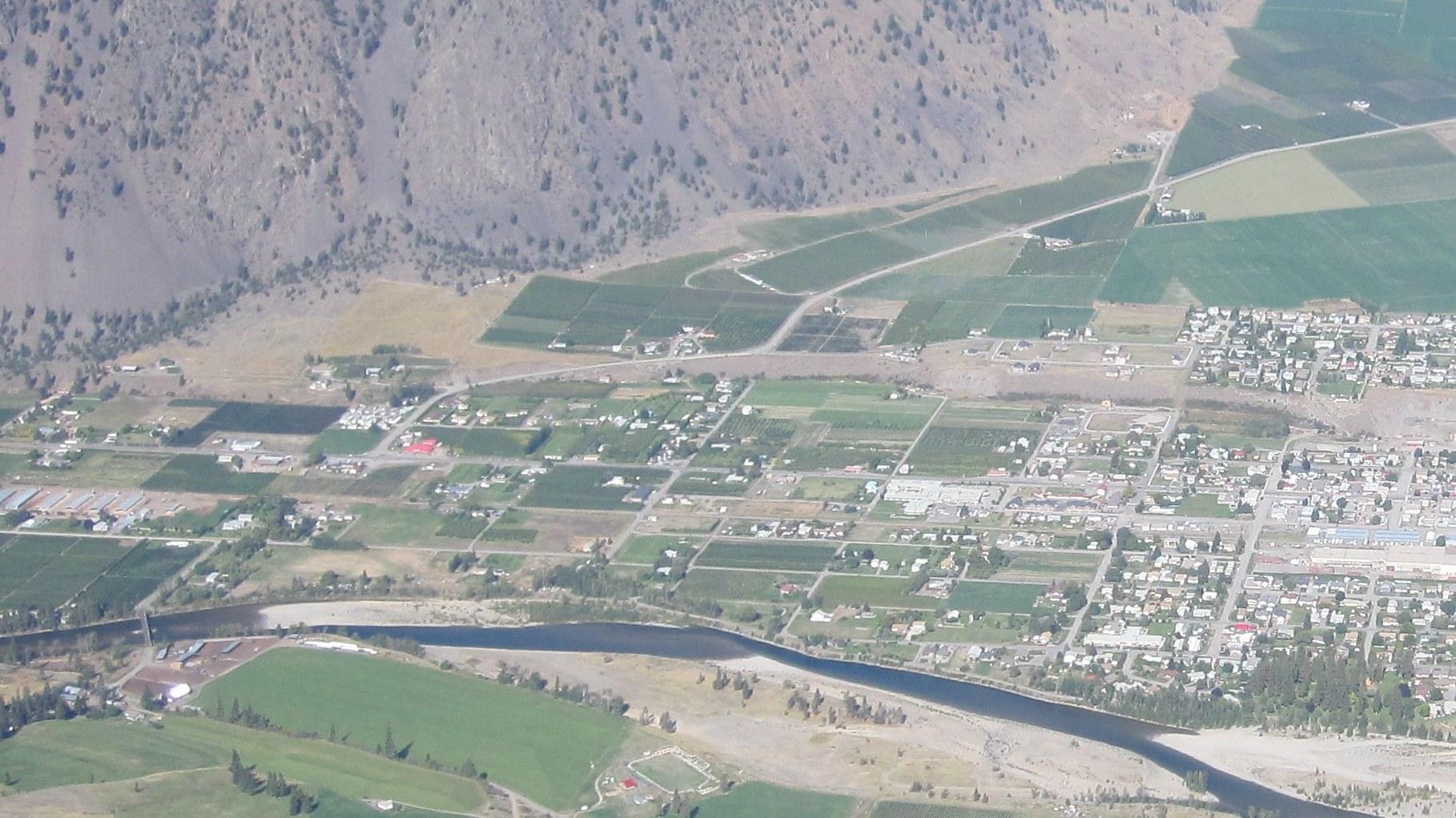
Keremeos is a village in the Similkameen region of British Columbia, Canada, and it likes to call itself the fruit stand capital of Canada. Soft fruits, apples, cherries, peaches and vegetables grow here in the dry, warm climate of the South Similkameen. Local legend says the name means the meeting of the winds, and K Mountain stands behind the village.
The village sits on the western boundary of Canada's Sonoran Desert and acts as the western gateway to interior wine country. New vineyards and wineries keep appearing in the valley. Orchards take up nearly one-third of the area of Keremeos, helped by plenty of sunshine and a vast aquifer that keeps refilling.
The scenery changes fast around Keremeos. Cottonwood groves follow the Similkameen River, dense orchards and farms fill the flats, desert-like ground spreads at the foot of the mountains, and alpine peaks and plateaux rise above. This semi-arid land holds hundreds of plant and animal species found only in the region, and Californian Big Horn Sheep and Mountain Goats are often seen on the mountainsides.
For a short look around, the Grist Mill and Gardens has a mill built in 1877 to turn grain into flour, with gardens on the site. The Red Bridge, also called the Ashnola Bridge, is a distinctive red span over the Similkameen River. Spotted Lake is a saline alkali lake full of minerals, and its water mostly evaporates over the summer, which reveals colourful mineral deposits.
Keremeos Columns Provincial Park protects vertical hexagonal rock columns that form a cliff on a hillside, comparable to Northern Ireland's Giant's Causeway but set in an inland forest. The park, established in 1931, covers 20 hectares. The columns themselves lie outside it, and public access onto the rock formation is not permitted.
Cathedral Provincial Park, southwest of Keremeos, is a stretch of jagged mountain peaks, lakes and alpine meadows with fishing, camping, wilderness camping, hiking and mountaineering. Three well-defined trails lead in from the Keremeos side, and you need at least a full day to hike one way into the core area.
Fishing is excellent in the lakes and rivers around Keremeos. Twin Lakes Golf Resort lies 21 km north of the Highway 3 and Highway 3A intersection at Keremeos, and Apex Mountain Ski Resort is an option for winter visitors. Around Cawston, near Keremeos, trails cover terrain from cactus and sagebrush desert to sub-alpine meadows.
Wild West storefronts, early orchards and a lost railway
Keremeos owes its Wild West look to 1909, when George Kirby, postmaster of the now-abandoned Upper Keremeos, bought land beside the Similkameen River in anticipation of the V.V. & E. Railway. The village was incorporated in 1956. Its economy has been agricultural since the first European settlers arrived in the mid-19th century. In 1864 Francis Xavier Richter, an immigrant from Bohemia, planted his original 30 acres of fruit trees at Keremeos Centre, and they count as one of the two foundations of the orcharding industry in British Columbia. The Grist Mill and Gardens, whose mill dates from 1877, belongs to the same farming story. The Vancouver, Victoria and Eastern Railway ran Keremeos-Hedley-Princeton service from 1909, and the Hedley-Keremeos section closed in 1954. Keremeos once had a train station, but no tracks remain in the Similkameen Valley from either the Great Northern Railway or the Kettle Valley Railway. Hedley lies about 30 km west of Keremeos along Highway 3. The former Grace Methodist building of 1903 is its oldest building, and the Hedley Country Market, known as the Motherlode Store, has operated since 1905. The Nickel Plate Mine worked from 1900 to 1955, and the Hedley Heritage Museum and Tea Room shows artifacts and photographs of the mining era. The Hedley Museum adds a Miner's Lounge with historical photographs and documents. Mascot Gold Mine Tours visit a former gold mine built into a mountainside 1500 m above the town of Hedley. The Lower Similkameen Indian Band is based at Keremeos, the Upper Similkameen Indian Band is at Princeton, and the region lies in the traditional territory of the Similkameen subdivision of the Okanagan (Syilx) people. The name itself comes from the Similkameen dialect word Keremeyeus, meaning creek which cuts its way through the flats, and it points to Keremeos Creek running down from the Upper Benchlands to the Similkameen River.
Fruit stands, farm markets and pub food on Highway 3
Keremeos is a place to buy fruit straight from the fruit stands along Highway 3 at the western end of the village, which is the usual summer and early fall purchase and includes apples, grapes, nectarines and peaches. The stands also sell pure apple juice and other fruit juices, and these taste different from the concentrated juices in grocery stores. If you drive in from Vancouver, the Keremeos fruit stands are the first ones you meet on Highway 3, and more follow around Oliver and Osoyoos. Parsons Farm Market is one of the farm markets along the highway in Keremeos. Mom & Pop's is a bistro and farm market whose family grows, picks and sells fruit and vegetables. For something different, Benja Thai Restaurant serves Thai food and is vegetarian friendly, while Blackbird Tavern is listed for good pub food. Oliver, east of Keremeos, is described as wine and orchard country, with more than 30 vineyards and over half of the vines in British Columbia. Cawston, in the south Similkameen Valley, has two fruit packing plants, the newest built for organic produce, along with many apple and soft fruit orchards, vineyards and wineries.
Getting to Keremeos by Highway 3, bus and nearby airports
Keremeos lies 340 km east of the Greater Vancouver area and is reached via Highway 3 from the Fraser Valley, Highway 5A from the Thompson Valley, and Highways 3 and 3A from the Okanagan Valley. On Highway 3, the Crowsnest Highway, Keremeos is 67 km southeast of Princeton, where the road meets Highway 3A leading toward Penticton and Highway 97. Osoyoos is another 46 km southeast. The whole of Highway 3 stretches 1,161 km from Hope, British Columbia to Medicine Hat, Alberta, and it is mostly two-lane. From Hope, Highway 3 runs 7 km east to the Coquihalla junction and then 127 km on the Hope-Princeton Highway. That stretch passes the Hope Slide, Allison Pass and Manning Provincial Park before it reaches Princeton, 67 km short of Keremeos. BC Transit Route 50 runs three days per week between Penticton and Princeton with stops in Keremeos. Travel time to Keremeos is 40 min from Penticton and 55 min from Princeton. The route runs year round with connections to Kelowna and Osoyoos, and it has been the only intercity transport since Greyhound ended service on the Hope-Penticton corridor on June 1, 2019. Mountain Man Mike's Bus Service also stops in Keremeos on its twice-weekly route between Kaslo and Vancouver, calling at Osoyoos, Princeton, Manning Provincial Park and Hope among other towns. The nearest airport with scheduled flights is Penticton Regional Airport, 41 km to the north, and the nearest major international airport is Kelowna International Airport. Two neighbours sit on the same highway: Hedley is about 30 km west of Keremeos, and Cawston lies about 8 km east, with Osoyoos 36 km farther east and Penticton 50 km to the north.
From the village to Cathedral Park and the Columns
Keremeos is the starting point for the road into Cathedral Provincial Park, and the Ashnola Road leaves Highway 3 3 km west of the village. The Ashnola Road crosses a red covered bridge, and the pavement ends 10 km further on. From there the Ashnola Forest Service Road continues along the Ashnola River into the park, extending 48 km upstream. Inside the park, no public roads exist, and hikers heading in from Keremeos have three well-defined trails to choose from. Keremeos Columns Provincial Park can only be reached on foot. Reaching the viewpoints for the columns takes a three hour hike each way, and since the park website does not explain the route, hikers use third-party trail maps.
Weather, camping and trail questions answered
Keremeos has a semi-arid climate with cool but short winters and hot, dry summers, and the questions below cover the numbers behind that. What are summer and winter like in Keremeos? Summer temperatures run 30-32 °C and winter temperatures 1-7 °C. Mean daily maximums are about 28 °C in July and August and about 0 °C in December and January, with record highs up to 39.5 °C in July and record lows near -26 °C in winter. How sunny and dry is it? Keremeos gets more than 2600 annual hours of sunshine and about 268 mm of rain a year. The average frost-free period is 181 days, with the last freeze around April 18th and the first around October 17th. When does the snow fall? Keremeos averages about 69 cm of snowfall a year, mostly from November to February, and December is the snowiest month at about 27 cm. Can I camp in Cathedral Provincial Park? The park has front-country vehicle-accessible camping and back-country camping, several day-use areas and the Cathedral Lakes Lodge. It has no public roads within it. How long does a hike into Cathedral Provincial Park take? You need at least a full day to hike one way into the core area. The park covers roughly 33,000 hectares and was first established on May 2, 1968. Is Highway 3 reliable in bad weather? During the 2021 British Columbia floods, Highway 3 through Keremeos was closed by landslides, but it was the first of the Lower Mainland routes to reopen.
FAQ
What is covered in the Keremeos guide?
Discover Keremeos in British Columbia: fruit stands on Highway 3, Similkameen orchards, hikes in Cathedral Provincial Park and how to plan your trip. It includes 1 recommendations across 1 gallery.
Next →How many places are in the Keremeos guide?
The Keremeos guide lists 1 places: 1 gallery.
Next →Where is Keremeos?
Keremeos is in Keremeos, British Columbia, Canada (49.2025, -119.8294).
Next →How do you get to Keremeos?
Keremeos lies 340 km east of the Greater Vancouver area and is reached via Highway 3 from the Fraser Valley, Highway 5A from the Thompson Valley, and Highways 3 and 3A from the Okanagan Valley. On Highway 3, the Crowsnest Highway, Keremeos is 67 km southeast of Princeton, where the road meets Highway 3A leading tow…
Next →What should you eat in Keremeos?
Keremeos is a place to buy fruit straight from the fruit stands along Highway 3 at the western end of the village, which is the usual summer and early fall purchase and includes apples, grapes, nectarines and peaches. The stands also sell pure apple juice and other fruit juices, and these taste different from the c…
Next →Is there camping in Keremeos?
No camping listings in this pack yet — we do not invent venues. Entries will appear once verified.
Next →Can you rent a bike in Keremeos?
No bike rental listings in this pack yet. Verified shops will be added when available.
Next →What are recommended gallery in Keremeos?
Highlighted gallery in the Keremeos guide: Keremeos seen from K Mountain.
Next →Highlighted places
- Keremeos seen from K Mountain — Keremeos and its fields beside the Similkameen River, seen from K Mountain.
Explore on the map
Tap a pin to highlight its place card
All
1 spots
Recommended places
Gallery
1 · 1 selected
Keremeos seen from K Mountain
gallery
Related guides
Browse nearby destinations
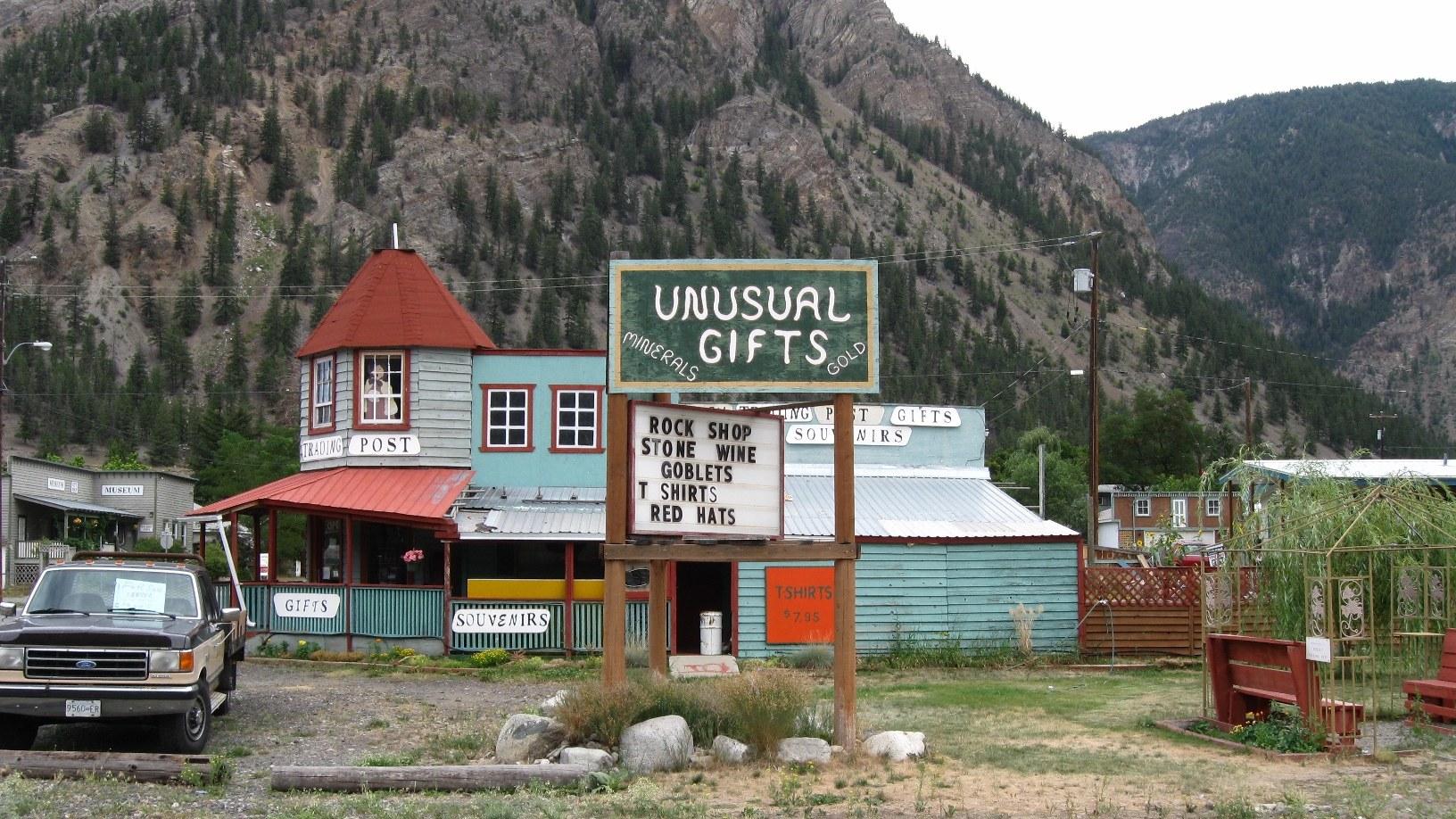
Hedley Guide
British Columbia, Canada
Old gold mining town in the Similkameen region
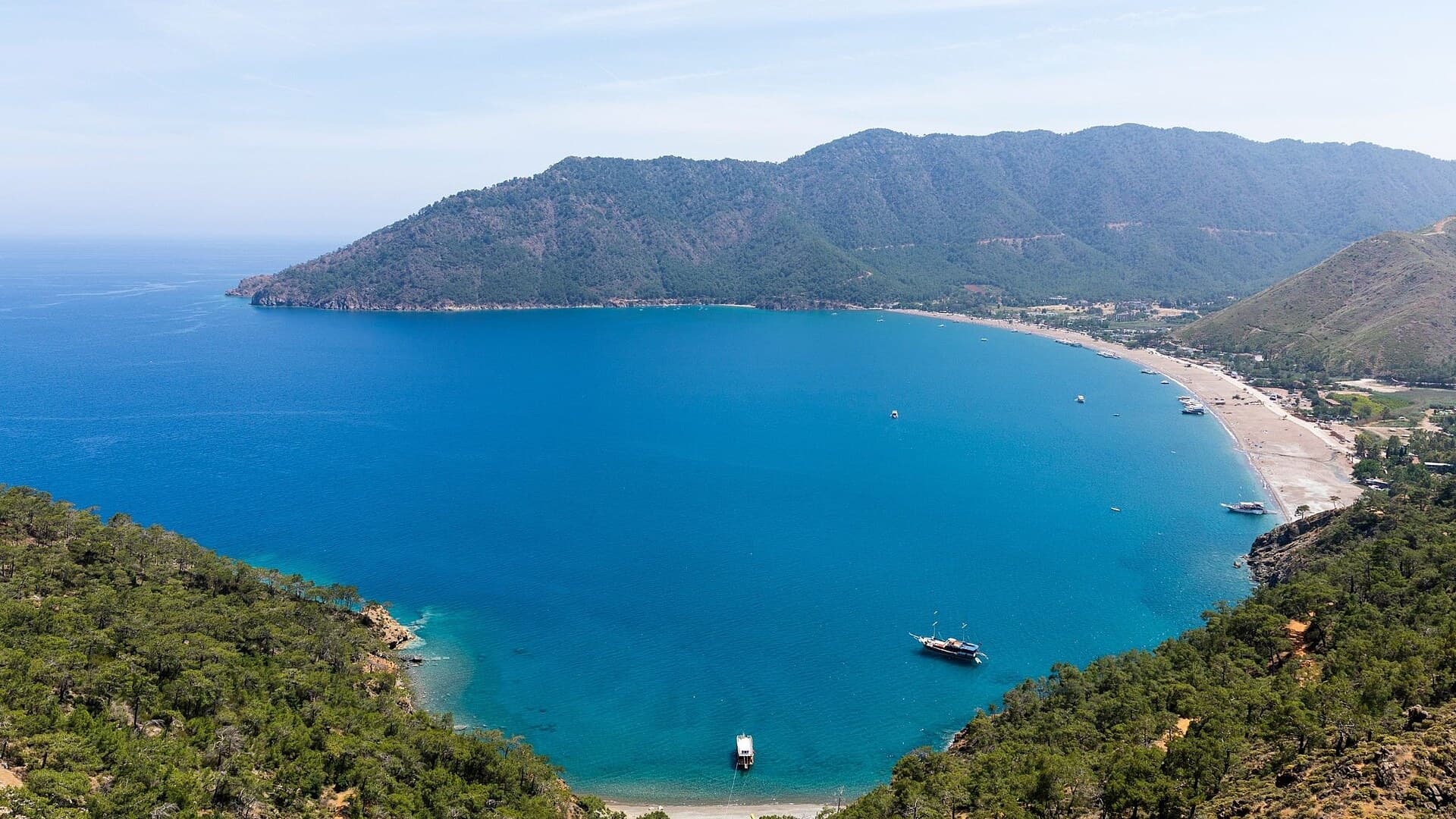
Adrasan
Antalya, TR
A pine-backed bay where the days move slowly
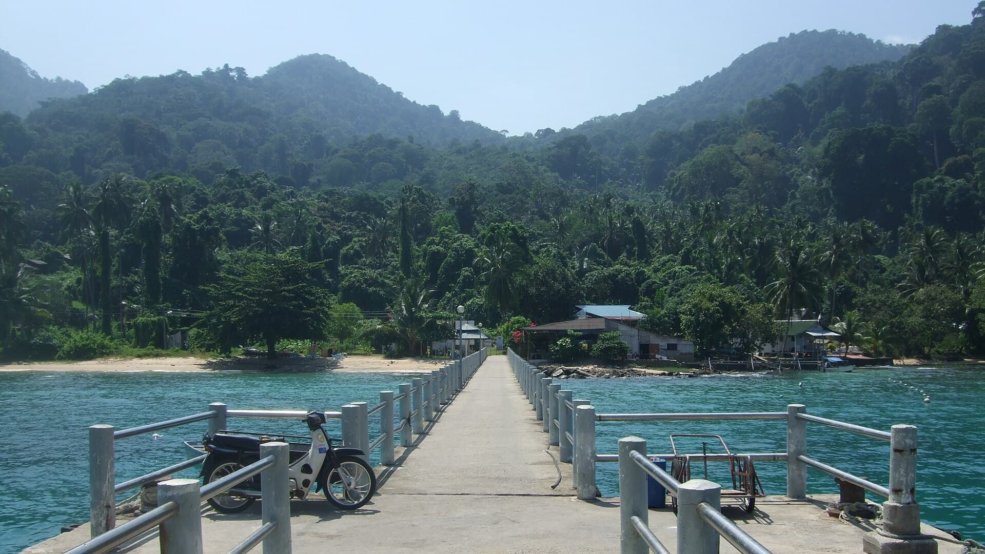
Air Batang
Pahang, Malaysia
A car-free Tioman village for divers and walkers
Akyaka
Muğla, Türkiye
Azmak boats, kitesurf wind and wooden balconies
Aneityum Guide
Tafea, Vanuatu
Beaches, reef and quiet in Vanuatu's far south
Angastaco Guide
Salta, Argentina
Torrontés wine and red hills in Salta's Calchaquí valley

Save these places to your list
Copy the spots you picked into your list — maps and notes included.